I’m always looking for useful value adding podcast, sites & videos. If you have one to share head over to the contact me page & send me an email with the link.
PODCASTS

Surveying the World ~ One Story at a Time ~ Delve in to lives of the interesting characters from the Surveying & Spatial Industry from all over the world & their unique perspectives on life & our Industry.

The podcast has a strong focus on construction related topics such as safety and how women have progressed through their careers and tips. The host is focused on promoting women’s workwear that is comfortable and fits.
PODCAST FOR THE GEOSPATIAL COMMUNITY
No long rambling introductions, we are not here to talk about the weather.
We interview experts and feature people that will help you learn more about GIS, geospatial, remote sensing and earth observation.

[Reality Capture Network] is a podcast and video series hosted by Nexus 3D Consulting. RCN was created as a way to share a passion for 3D technology with business owners, industry leaders and entrepreneurs. It’s also the largest network of 3D Reality Capture Professionals in North America! We will be interviewing experts and leaders in the industry and cover topics such as 3D laser scanning, surveying, UAV/drones, point clouds, virtual reality, BIM, AI, computer hardware / software, and cover the uses within every industry!
The Locate conference attracts national and international delegates from within and outside the spatial & surveying industry. As Australia’s premier spatial & surveying conference, Locate provides guests with a unique opportunity to learn about the latest trends and applications in geospatial technologies. Find interviews from the geospatial community. Hosted by Roshni Sharma
WEBSITES
Drone Education and Geospatial Experts Empowering Educators
We believe every student deserves to succeed with STEM, and every teacher should be empowered to help them do it.
GeoNadir is the only earth observation platform focusing on FAIR drone data, and the only FAIR drone data platform focusing on environmental earth observation. GeoNadir will do what it takes to support the global efforts to manage the effects climate change for ethical and sustainable futures.
Inspiring future geospatial experts!
Bringing young people into the exciting world of survey through pioneering content and engaging experiences

Do you ever wish that you could have a weekly cup of coffee with like-minded surveying professionals? We are here to tell you that you can do just that – by participating in the virtual Mentoring Mondays program.
YouTube
Check out and Subscribe to The Geoholics YouTube to watch the podcast

The Global Surveyor | Land Surveying, Hiking & Mapping Adventures. Scott Taylor is a NSW Registered Land Surveyor combining GPS, GNSS, and RTK surveying with rugged bush hiking and outdoor exploration. I search for lost boundaries, ancient survey marks, and hidden landmarks in remote wilderness.
Rami Tamimi, is an American Ph.D. student at The Ohio State University working towards his Doctor of Philosophy in Geodetic Engineering. With over a decade of experience in the Land Development Industry, his work revolves around traditional field surveying and design work using AutoCAD Civil 3D and Carlson. Most of his recent work involves geospatial technology including LiDAR, SONOR, and Photogrammetric data acquisition and processing with the use of Unmanned Aircraft Systems or Drones. He holds a Bachelor of Science in Surveying Engineering and a Master of Science in Civil Engineering. His objective with this channel is to educate tech savvy people about the fundamentals of measurements and encourage old school surveyors to embrace the new technology as a helpful tool for our industry.
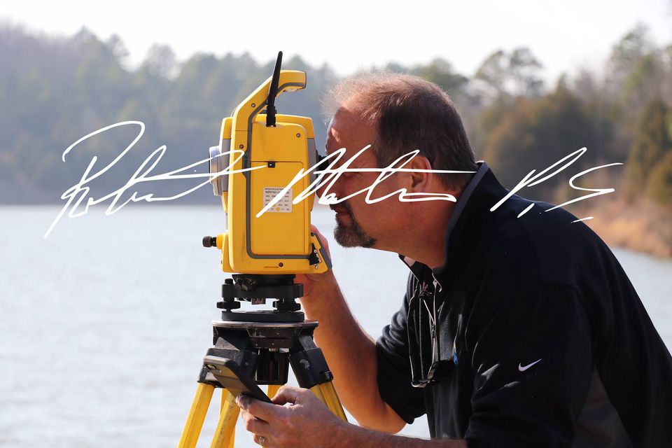
Robert Martin helps surveyors in all facets of the surveying industry solving their most difficult problems from field to finish. It takes hard work, patience, dedication and a lot of technical savvy to solve problems and Robert has the passion and commitment to meet the task.

Lessons on Math, Geography and Coding from a Land Surveyor (USA)
